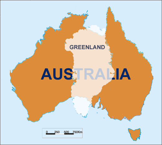
The question made me think for a moment. If we are to see the map we are using in school, it is obvious that Greenland is bigger than Australia. If that is true then we can say that an island is bigger than a continent which sounds unusual. In order to resolve this conflict in my head, I tried searching it in Google. After a bit of research and some clicks, I found out that
the answer to that question is No(I knew it). My coming up to the resolution again gave rise to another question, Why does Greenland look larger than Australia in maps? The answer is on the map itself! It's
because of the map projection. In making the maps, the places near the poles seems to be stretched more compared to the equator. The reason behind this is to be able to lay the spherical surface of the earth into a flat surface
*. Here is the proof to the answer.
*Note that I changed "standardize the scale that is to be used in the map" to "be able to lay the spherical surface of the earth into a flat surface" (since April 30, 2013). Leave a comment below so I can know if the change I made is just fine or bad.


No comments:
Post a Comment